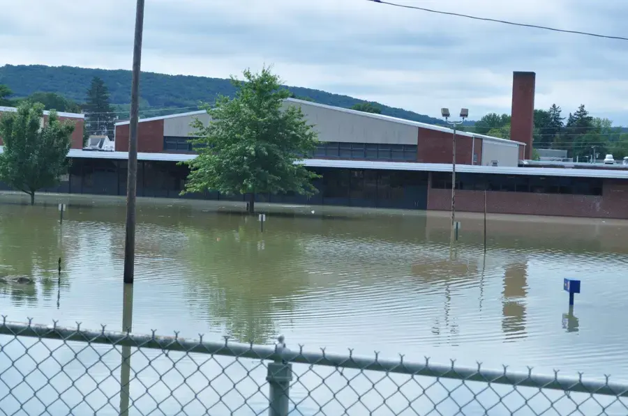
Clayton sits at the foot of Mount Diablo, and Mt. Diablo Creek runs straight through the city. When the creek or the creeks that join it spill, the water that reaches a house is flood water, not a pipe leak. This post explains how creek flooding has affected Clayton, why a federal rule put about 200 homes in the floodplain, and how the cleanup works.
Key takeaways
- Mt. Diablo Creek is the principal stream through Clayton, and Donner Creek, Mitchell Creek and Peacock Creek join it inside the city.
- The creek has flooded the Clayton Town Center and the floodplain between Clayton Road and Kirker Pass Road, with major floods in 1938, 1952, 1955 and 1963.
- A FEMA rule on berms placed about 200 more homes along Mt. Diablo Creek north of Clayton Road in the 100 year floodplain.
- Creek water is treated as contaminated, so porous materials are removed and surfaces are cleaned before drying.
- Flood coverage is usually separate from a standard homeowner policy, so the insurer should be asked early.
The creeks that run through Clayton
Mt. Diablo Creek is the principal stream through Clayton. Donner Creek, Mitchell Creek and Peacock Creek join it inside the city.
The city maintains its streets, sidewalks and storm drains with advice from the Contra Costa County Flood Control and Water Conservation District. Creek trails such as Mitchell Creek Trail, Mt. Diablo Creek Trail, Cardinet Trail and Donner Creek Trail follow some of these channels.
Clayton sits at the foot of Mount Diablo, and Mount Diablo State Park forms much of its southern boundary. That puts a lot of hillside above the creek channels.
- Mt. Diablo Creek: the principal stream.
- Donner Creek, Mitchell Creek and Peacock Creek: tributaries inside the city.
- Marsh Creek: named in local reports of the December 31, 2022 storm.
What Clayton's flood history shows
Mt. Diablo Creek has flooded the Clayton Town Center and the floodplain between Clayton Road and Kirker Pass Road. Major floods hit the Clayton area in 1938, 1952, 1955 and 1963.
Flood maps changed more recently. FEMA updated maps for Clayton in 2006, and digital maps took effect on June 16, 2009.
A FEMA rule on berms placed about 200 more homes along Mt. Diablo Creek north of Clayton Road in the 100 year floodplain.
- Town Center and the area between Clayton Road and Kirker Pass Road have flooded before.
- The floodplain map changed in 2006 and 2009.
- Homes added to the 100 year floodplain may now be treated differently by lenders and insurers.
The December 31, 2022 atmospheric river
On December 31, 2022 an atmospheric river brought flooded streets and overflowing streams to Concord and Clayton, with Marsh Creek barely containing the water. Marsh Creek Road between Brentwood and Clayton closed because of rock slides and mud.
That storm is a reminder that Clayton's flooding is not only a creek problem. Hillside runoff, debris and drains that cannot keep up add to the water that reaches a house.
Clayton has a warm summer Mediterranean climate with hot, dry summers, so creek channels that sit quiet for months can carry far more water once the wet season starts.
- Water from creeks and from hillside runoff arrive together in a big storm.
- Roads can close, which slows everything from repairs to supplies.
- Homes at the foot of Mount Diablo may see water from more than one direction.
How creek flood water differs from a pipe leak
A pipe leak starts as clean water. Creek water has crossed soil, roads and yards, so it is treated as contaminated.
That means carpet and pad that creek water touched are usually removed, and drywall is cut above the flood height where readings show it is wet. Surfaces are cleaned and treated before drying equipment runs.
- Clean water: a supply failure caught early.
- Gray water: appliance or overflow water.
- Creek and flood water: contaminated and treated with removal.
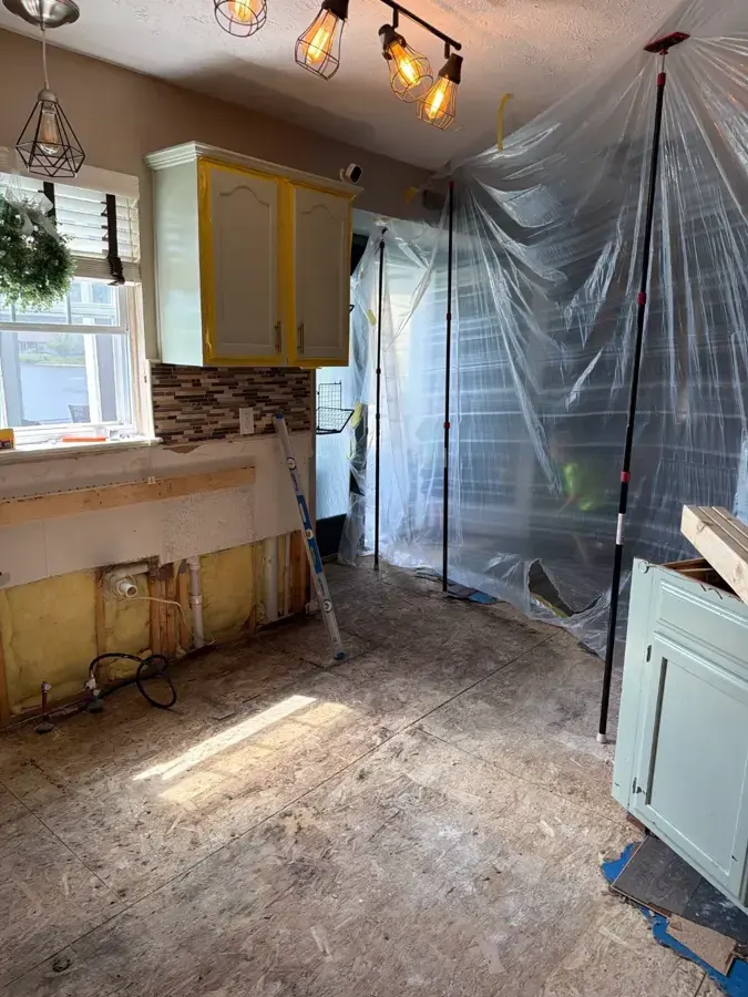
What cleanup looks like in a Clayton home
Most Clayton homes were added in waves from the 1970s through the 1990s, so many are detached houses. A creek event can leave water on the lower floor and in the garage.
A storm flood cleanup crew starts with the standing water and silt. Fast water extraction keeps water from wicking up into the walls.
The crew then removes porous materials, cleans and treats surfaces, and sets air movers and dehumidifiers. Daily readings show when framing and subfloor are dry.
Hillside runoff can bring mud and debris with the water, so floors and wall bases are cleared of silt before drying begins. Silt left behind can hold moisture and keep a wall wet.
Clayton homeowners who want a closer look at the process can read the main storm flood page, which covers containment, treatment and drying in order.
- Standing water and silt pumped and cleared.
- Carpet, pad and wet drywall removed.
- Surfaces cleaned and treated.
- Drying equipment run until readings reach a dry standard.
Contents, garages and the lower floor
A creek event usually hits the lowest part of a house first. In many Clayton homes that means the garage, a laundry room or the ground floor, where stored items and appliances sit.
Water in a garage can reach the shared wall and the room beyond, so those areas are checked even when the garage seems to be the only wet space.
Contents are sorted the same way as in any flood loss: hard items cleaned, porous items discarded and a list kept for the claim.
- Garage stored goods and cardboard.
- Washers, dryers and water heaters set low.
- Lower cabinets and the base of walls.
- Wood floors that creek water covered.
Insurance, lenders and floodplain status
A home in a mapped floodplain may have a lender requirement for flood coverage, and a home outside it can still flood. Standard homeowner policies often exclude flood water, so a separate policy may apply.
Photos, readings and a written scope from the restoration crew help with a claim. The Clayton water damage page lists the other kinds of loss handled in the city.
For a broader look at the process, the main storm flood cleanup page covers each step.
Clayton's housing is mostly owner occupied, with few multi family units and few renters, so most losses fall directly on the homeowner. A written scope and readings from the start make a claim easier to explain.
- Ask the insurer whether the policy covers flood water.
- Keep photos of the water level and the damage.
- Keep a list of damaged items with dates.
Questions
Which creek runs through Clayton?
Mt. Diablo Creek is the principal stream, and Donner Creek, Mitchell Creek and Peacock Creek join it inside the city.
Has the Town Center flooded before?
Yes. Mt. Diablo Creek has flooded the Clayton Town Center and the floodplain between Clayton Road and Kirker Pass Road.
What did the berm rule change?
A FEMA rule on berms placed about 200 more homes along Mt. Diablo Creek north of Clayton Road in the 100 year floodplain.
Is creek flood water safe to leave in carpet?
No. It is treated as contaminated, and carpet and pad that it touched are usually removed.
Can a home outside the floodplain still flood?
Yes. Hillside runoff, drains that back up and storms like December 31, 2022 can put water in homes outside mapped areas.
Who maintains storm drains in Clayton?
The city maintains its streets, sidewalks and storm drains, with advice from the Contra Costa County Flood Control and Water Conservation District.